Where should we expect to find the ancient cities of Sodom and Gomorrah? I already addressed this matter in part in Post #9 about Lot’s Cave in the vicinity of Zoar. In that post I used the evidence of the biblical text, of toponomy (linguistics of place names), and the Medeba Map. In addition, we can add a few more arguments derived from the biblical text with regard to Sodom and Gomorrah.
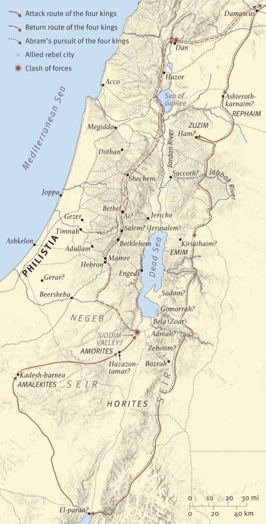
The list of locations in Genesis 10:19 (NASU: “The territory of the Canaanite extended from Sidon as you go toward Gerar, as far as Gaza; as you go toward Sodom and Gomorrah and Admah and Zeboiim, as far as Lasha”) contains two different types of statements: “as you go toward” and “as far as.” Those create a situation that breaks up any possible direct order of locations along a border line. First, Gerar is southeast of Gaza, so the border of Canaan runs south along the Mediterranean coast (perhaps having in mind the Via Maris) to Gaza and then runs east to Gerar (perhaps having in mind the desert road followed by caravans between Arabia and Egypt). Also, “Sodom and Gomorrah and Admah and Zeboiim” appears to be a grouping of cities in close proximity to one another. They serve as an anchor for the southern border running eastward from Gerar. That could indicate, by the previous pattern, that Lasha should be located as the anchor where the eastern border turns from the southern border (just as Gaza was the anchor point for the western and southern borders. That would indicate, therefore, that the boundaries of Canaan listed only the western and southern boundaries. That is why some think Lasha should be the anchor point at the north-east. It’s possible that the text failed to provide the eastern and northern boundaries because it was obvious that the boundary of Canaan on the east was the Jordan Rift and the north boundary eastward from Sidon would mirror the border on the south. In any case, the cities of Sodom, Gomorrah, Admah, and Zeboiim are as directly east of Gaza just as Gaza is directly south of Sidon. That places those cities in the vicinity of the southern end of the Dead Sea — no other location fits the text. Interestingly, the one city missing in this four-city grouping is Zoar/Bela. This group of four destroyed cities occurs 15 times in the OT. Lasha appears only in Genesis 10:19. Its ultimate location does not move the four-city group from its southeastern location east of Gaza and Gerar.
Another key text indicating the location for Sodom and Gomorrah consists of Ezekiel 16:46. In that text we learn that Sodom with her nearby cities lies south of the city of Jerusalem, just as Samaria lies to the north of Jerusalem. The map above shows quite clearly that any site at the northern end of the Dead Sea fails to meet this description (the map labels Jerusalem as Salem).
Yet another piece of biblical evidence involves the mention of “tar [or, bitumen] pits” in “the valley of Siddim” (Genesis 14:10). The area around the southern lobe of the Dead Sea remains the only location providing such geological indicators.
Numeira
As we toured the site at Numeira, we noted that the current name could reflect the ancient name of Gomorrah (עֲמֹרָה). The ‘ayin (ע) represents the first letter of Gomorrah in biblical Hebrew, not a gimel (ג) as some might think. The Septuagint’s (LXX) use of gamma in the name (Γομορρα) indicates a second vocalization of the Hebrew consonant akin to the Arabic ghayin. We see the same phenomenon in the name Gaza (עַזָּה, Γάζα). A possible phonetic and linguistic transition of the ghayin consists of the nu syllable commencing the Arabic name by representing a nasalization of the ghayin.
Initial laryngeals like the ayin in ‘MR were commonly lost or transformed in the process of time, or when they came over into other languages or dialects. In this case, it is possible that nasalization took place, so the ayin in Hebrew ‘MR became the N in Arabic NMR (Shea 1988: 17).
— Bryant G. Wood, “The Discovery of the Sin Cities of Sodom and Gomorrah,” Bible and Spade 12, no. 3 (Summer 1999): 69
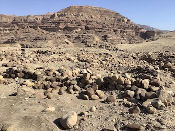
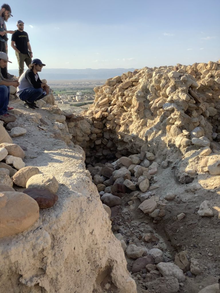
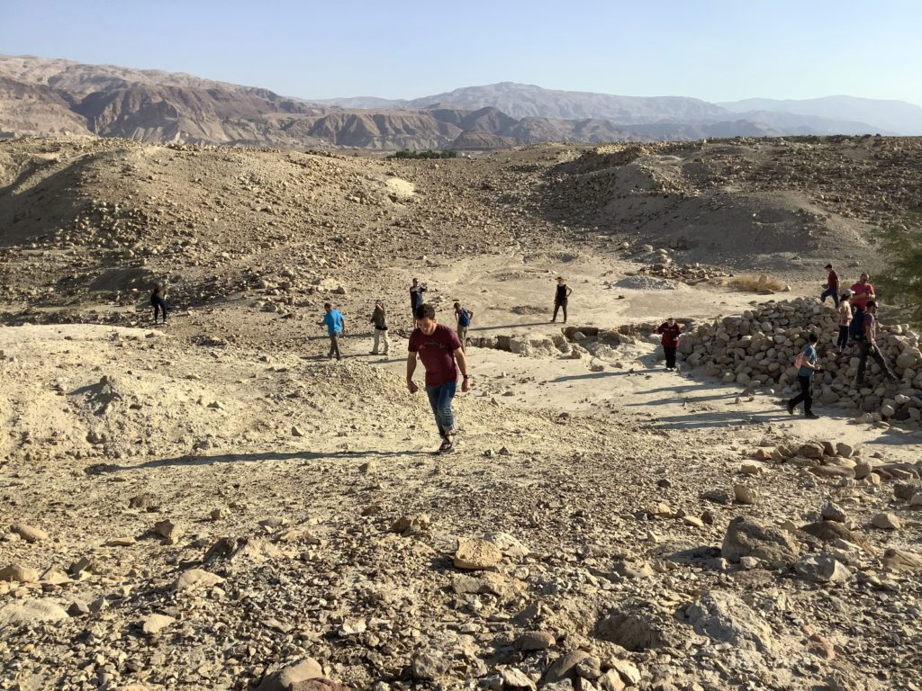
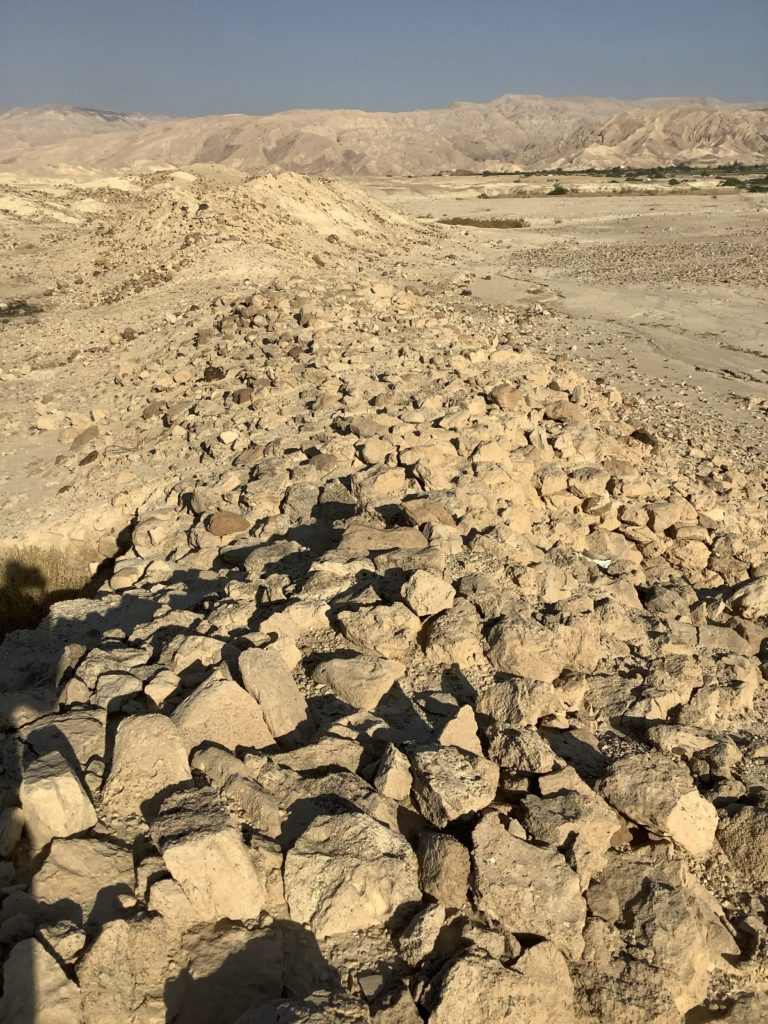
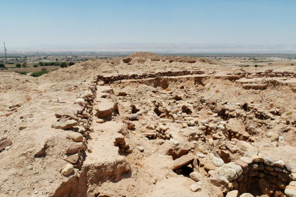
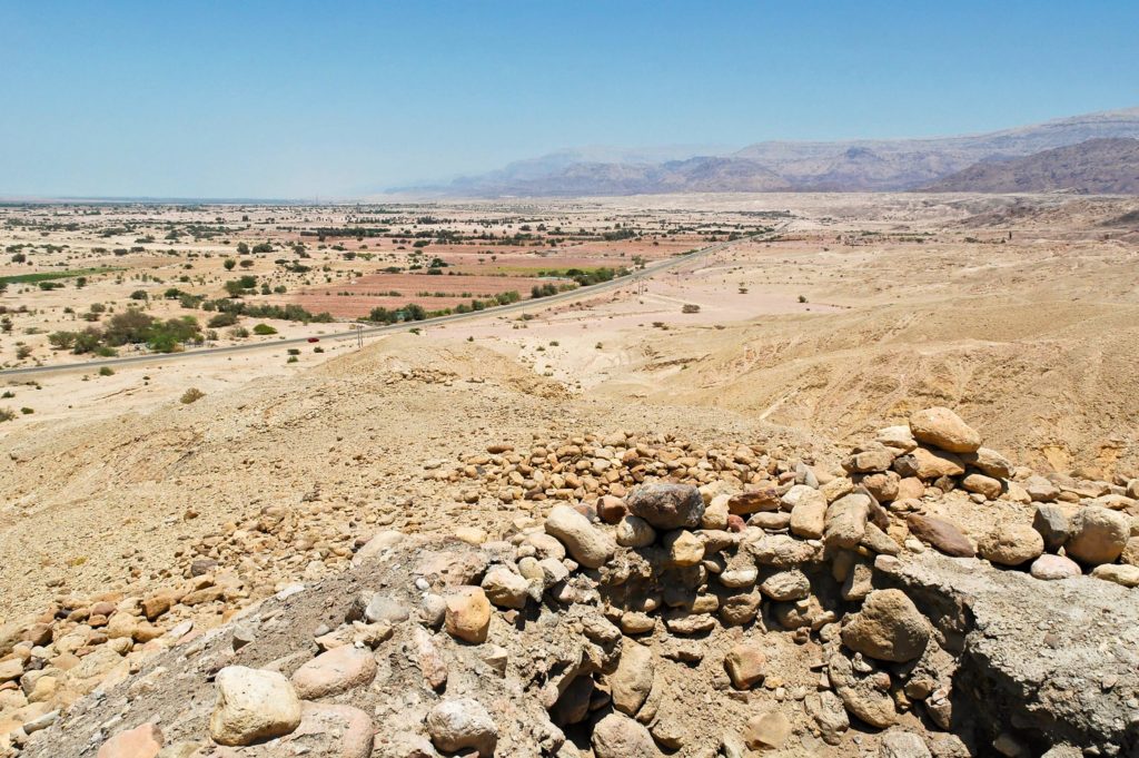
The tell at Numeira lies a little east of the highway on the east side of the Dead Sea. It covers an area of about 2.5 acres. As we walked to the top of the tell, we could see that it sits on an alluvial spur jutting westward out of the north-south range bordering the Jordan Rift on the east. Its situation places it at approximately 900 feet below sea level (the Dead Sea sits at a little over 1300 feet below sea level). On the north side of the tell Wadi Numeira contains a running stream of water. This stream might be the source of the name of the site since namir (Arabic) means “with ample water.” From 1977 until 1983 four seasons of excavation took place under the direction of Walter Rast, R. Thomas Schaub, and Michael D. Coogan. Mohammad Waheeb of the Department of Antiquities of Jordan also conducted some excavation along the site’s west wall. The northern wall of the city has eroded away into Wadi Numeira. Only the southern wall remains mainly in place with its debris strewn down the southern slope of the tell. Evidence points to a destruction by fire late in Early Bronze III (ca. 2300 BC) with no subsequent habitation.
The destruction preserved many finds, including wooden roofing beams, a sickle blade and part of its wooden haft, grapes complete with their skins and stems, barley grains inside bins and jars, and three male human skeletons trapped by falling walls.
— Peter M. Fischer et al., “Jordan,” in The New Encyclopedia of Archaeological Excavations in the Holy Land, ed. Ephraim Stern, 24–36 (Jerusalem: Israel Exploration Society; Washington, DC: Biblical Archaeology Society, 2008)
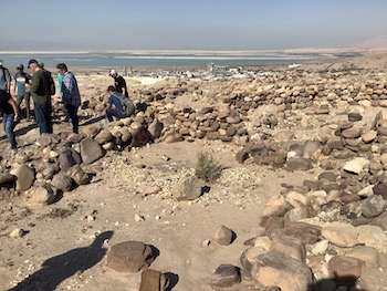
The ash layer at Numeira has been measured at over four feet in thickness in some areas of the tell. The excavators determined that two different destruction layers exist separated by about 25 years or more. The first destruction could have been due to the attack of Chedorlaomer’s coalition in Genesis 14. The second destruction could be the divine judgment described in Genesis 19. Despite weathering of the tell surface, the final layer of ash rests on the surface or just beneath the wind-driven sand and dust layer covering the tell. It demonstrates that the site was never reoccupied regardless of the perennial stream that still runs at the base of the tell. The area remains “well watered” (Genesis 13:10) even today — one of the evidences testifying to the accuracy of this area’s identification with the “cities of the kikkar” (Genesis 13:12). The Hebrew kikkar refers to a region or area, not necessarily to “plain” (CSB, NRSV) or “valley” (NASU, ESV).
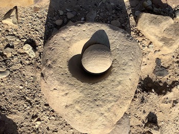
One problem with Numeira’s currently accepted chronology relates to its identification with Gomorrah, whose destruction most conservative biblical scholars date to around 2100 BC. The issue points to the necessary re-examination of archaeological evidence and the use of Carbon 14 dating for some of the finds (e.g., wood, grain, olive pits, bones). A 2011 doctoral dissertation by Kris J. Udd at Andrews University examined these issues and suggested the following chronological recalibration:
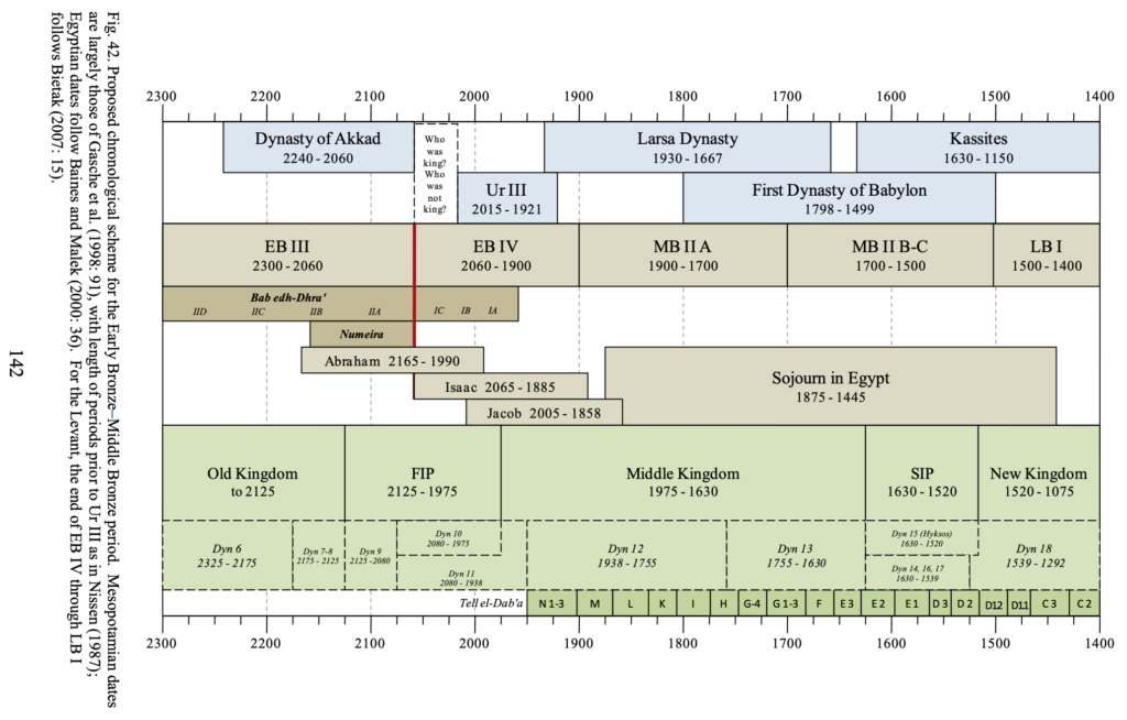
Such a recalibration coordinates a low archaeological chronology with a high biblical chronology. It results in viable dating parameters agreeing with the Bible and treating it as an accurate historical document.
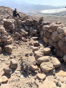
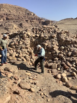
Builders of the ancient city wall at Numeira recognized the need for a greater defense wall on the east where invaders could most easily attack the city. A tower helped to fortify the eastern wall (see picture above). A skeleton of a male was uncovered in the tower’s debris from what appears to be the earlier destruction. Other skeletons were discovered relating to the final destruction of Numeira. Interestingly, burials in the cemetery at Bab edh-Dhra (see below) include some with evidence of having been inhabitants of Numeira. Archaeologists have not discovered any cemetery in the immediate area of Numeira.
Resources on Numeira: Creighton University’s Virtual World Project. Bryant G. Wood, “The Discovery of the Sin Cities of Sodom and Gomorrah,” Bible and Spade 12, no. 3 (Summer 1999): 67–80. Todd Bolen, “Numeira,” BiblePlaces.com.
Bab edh-Dhra
The name Sodom has been preserved in the Arabic Jebel Usdum, Mount Sodom, a hill near the southwestern shore of the Dead Sea. The modern name of the tell, Bab edh-Dhra (“gate of the arm”), does not preserve any ancient name provided in any ancient monuments or documents, unless it proves to be biblical Sodom. The tell is bordered on the north by Wadi Kerak.
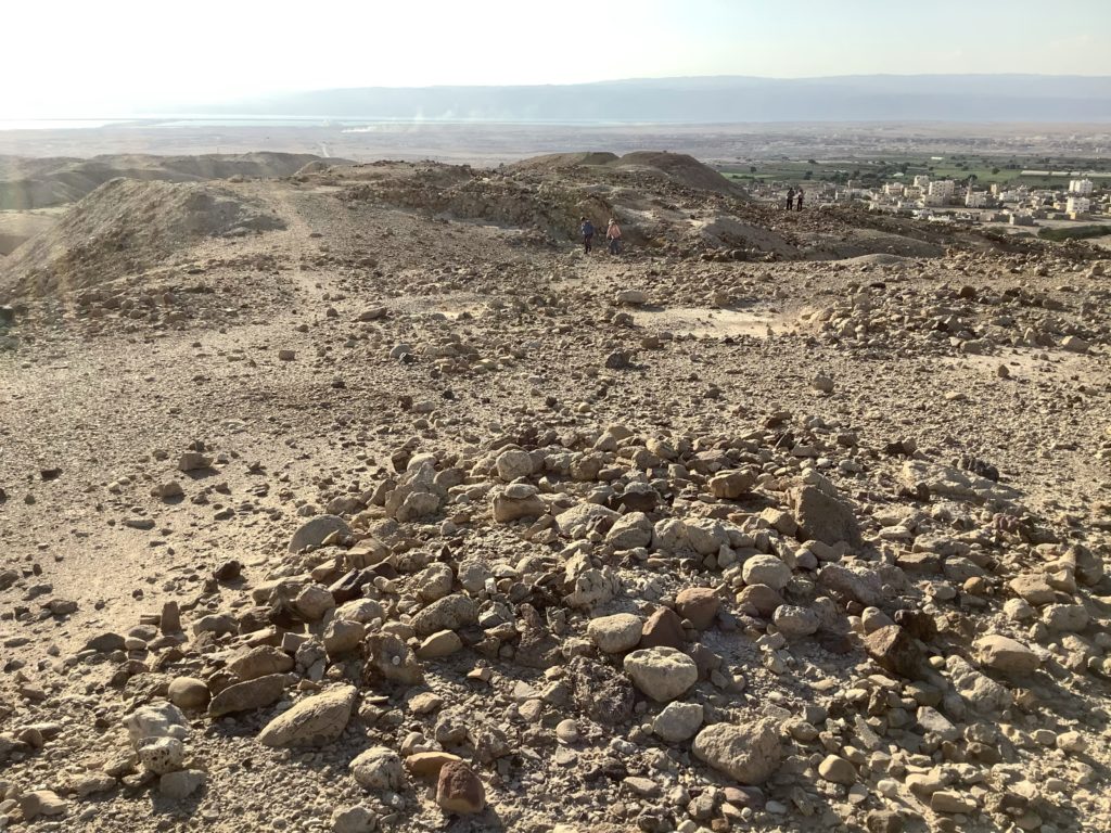
Before visiting the tell itself, we went to a ridge from which we could view much of the massive cemetery on the opposite side of the highway leading to the city of Kerak. There we looked over the vast area and its many tomb sites.
One scholar has estimated that the cemetery is composed of more than 20,000 tombs in which over 500,000 people were buried together with over 3 million pottery vessels.
— “Have Sodom and Gomorrah Been Found?” Biblical Archaeology Review 6, no. 5 (September/October 1980): 28
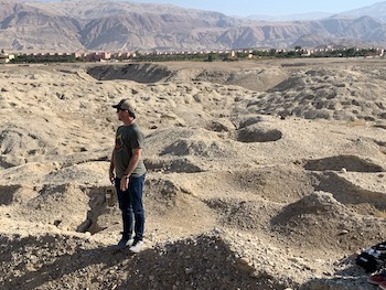
Area inhabitants used the cemetery near Bab edh-Dhra for 1,000 years starting as early as 3100 BC. Many of the burials utilized shaft tombs.
These shaft tombs consist of a round shaft about three feet in diameter and six feet deep and one or more burial chambers at the bottom of the shaft. The shafts are dug straight down into the ground. At the bottom of the shaft are from one to five ball-shaped burial chambers which lead off from the shaft itself. The entrance to each burial chamber from the base of the shaft, was closed with a flat blocking stone.
— “Have Sodom and Gomorrah Been Found?” Biblical Archaeology Review 6, no. 5 (September/October 1980): 36
That’s why the tombs appear in the photo above as pits — those pits, when cleared of the soil filling their mouths, reveal a vertical shaft leading to the rooms opening up horizontally from the shaft. Residents later constructed charnel houses to rebury the bones from multiple shaft burials. Some of those charnel houses contained remains from several hundred bodies. Intriguingly, some of these charnel houses presented evidence of burning. Such information appears in the reports of Rast and Schaub for the Expedition to the Dead Sea Plain.
Scripture gives greater prominence to Sodom than to Gomorrah. Nineteen times the two cities are mentioned together, but the biblical text refers to Sodom alone twenty times. A similar phenomenon appears in the New Testament (cp. Matthew 10:15 and Matthew 11:23–24, as just a couple of examples). This, together with the massive cemetery at Bab edh-Dhra, makes this tell a key target for future excavations. While we stood atop the tell we gathered everyone together for a special announcement. Tim Sigler, Provost and Dean of Shepherds Theological Seminary (Cary, NC), revealed the early stages of establishing a department of biblical archaeology at the seminary. It was my joy and privilege to be asked to pray about this endeavor as we stood there at Bab edh-Dhra in Jordan overlooking the Dead Sea. Shepherds will require students who enroll in the seminary’s archaeology program to obtain field experience. It is possible that one of the potential sites of the cities of the kikkar might provide that type of excavation experience.
Excavations at Bab edh-Dhra took place under Paul Lapp (1965–1967) and by Walter Rast and Thomas Schaub starting in 1973. Surveys and excavations of the site continue under the American Schools of Oriental Research (ASOR). Some details about excavations in the cemetery are available online at the University of Melbourne’s Classics and Archaeology Virtual Museum page.
Resources: “Have Sodom and Gomorrah Been Found?” Biblical Archaeology Review 6, no. 5 (September/October 1980): 26–36. Bryant Wood, “Locating Sodom: A Critique of the Northern Proposal,” Bible and Spade 20, no. 3 (Summer 2007): 78–84. Bryant G. Wood, “The Discovery of the Sin Cities of Sodom and Gomorrah,” Bible and Spade 12, no. 3 (Summer 1999): 67–80. For the northern hypothesis for the location of the cities of the kikkar, see Steven Collins, “Where Is Sodom?” Biblical Archaeology Review 39, no. 2 (2013): 33–38, 40–41, 70.
Admah and Zeboiim
These two cities of the kikkar occur only in Genesis 10:19; Deuteronomy 29:22; and Hosea 11:8. They remain unidentified with any specific site. Any potential site would most likely be associated with an existing wadi or spring.
That there are five and only five sites located in the Dead Sea area—each located near a flowing spring; that all five date to the same archaeological period—the Early Bronze Age; and that there is no other evidence of occupation in the area until the Roman period over 2000 years later is not without significance.
— “Have Sodom and Gomorrah Been Found?” Biblical Archaeology Review 6, no. 5 (September/October 1980): 32
According to Genesis 14:1–16, the Elamite king Chedorlaomer and his allies defeated an alliance of kings that included the kings of Admah (Shinab) and Zeboiim (Shemeber). Four of the five cities (minus Zoar, which was spared) find mention together in Deuteronomy 29:23. Admah and Zeboiim occur alone together in Hosea 11:8. Each reference deals with divine judgment and destruction. Early Bronze ruins found at Bab edh-Dhra, Numeira, Feifeh, Khanazir, and Es-Safi — all associated with the southeast quadrant of the Dead Sea must be investigated more fully since current evidence remains inconclusive.
Resources: Todd Bolen, “Jordan,” Pictorial Library of Bible Lands, vol. 6, revised and expanded (DVD 2018). Josh McDowell offers an insightful blog answering the question, “Does Archaeological Evidence Prove The Bible? How Do Archaeological Discoveries Relate To Events In Scripture?” His answer should be adopted by every reader of the Bible.

Love this series of posts! Just one minor caveat in this post that I am sure you have already considered – but others, maybe not so much: all the biblical dates prior to the sojourn in Egypt as reflected in the (generally excellent) chronological recalibration chart – may be 215 years too far into the past due to the assumption of a 430 year sojourn in Egypt. A sojourn of 215 years is reflected in the LXX (and consequently, the NT). The LXX may reflect the older and better Hebrew text and should at least be considered for chronological purposes by conservative students/scholars.
Thank you for your comment, Todd. I am not totally sold on the 215 year theory based on the LXX. Most of the LXX represents either an inferior Hebrew text or a poor translation of the Hebrew text (basically the same as the Masoretic Text). An argument can be made for giving greater consideration to some parts of Genesis (such as the genealogies — see the work being published on the Associates for Biblical Research website by Henry Smith), but we must not underestimate the legitimacy of the Hebrew text as we have it. As I point out in this series of posts, the research is ongoing and much remains to be accomplished. Several potential solutions to the difficulties have been proposed. My main focus was placed on sticking to the biblical text as prima facie evidence, rather than jettisoning the text or treating it as though it can only be depended upon if there is extrabiblical evidence to support it.