
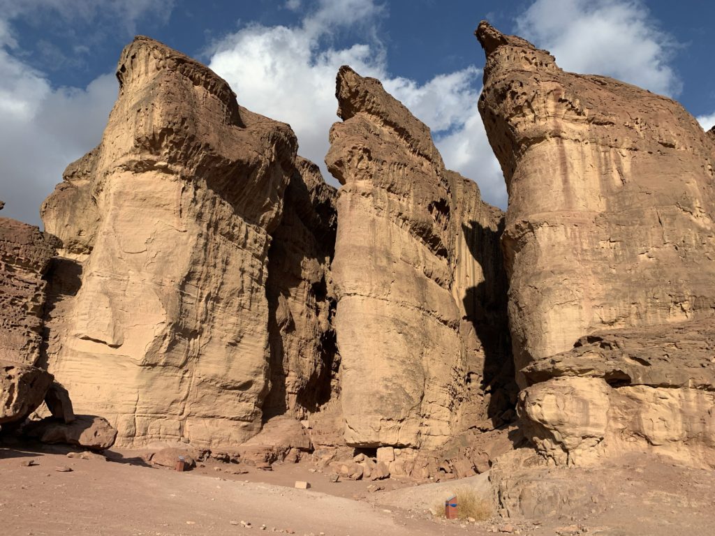
Timnaʿ
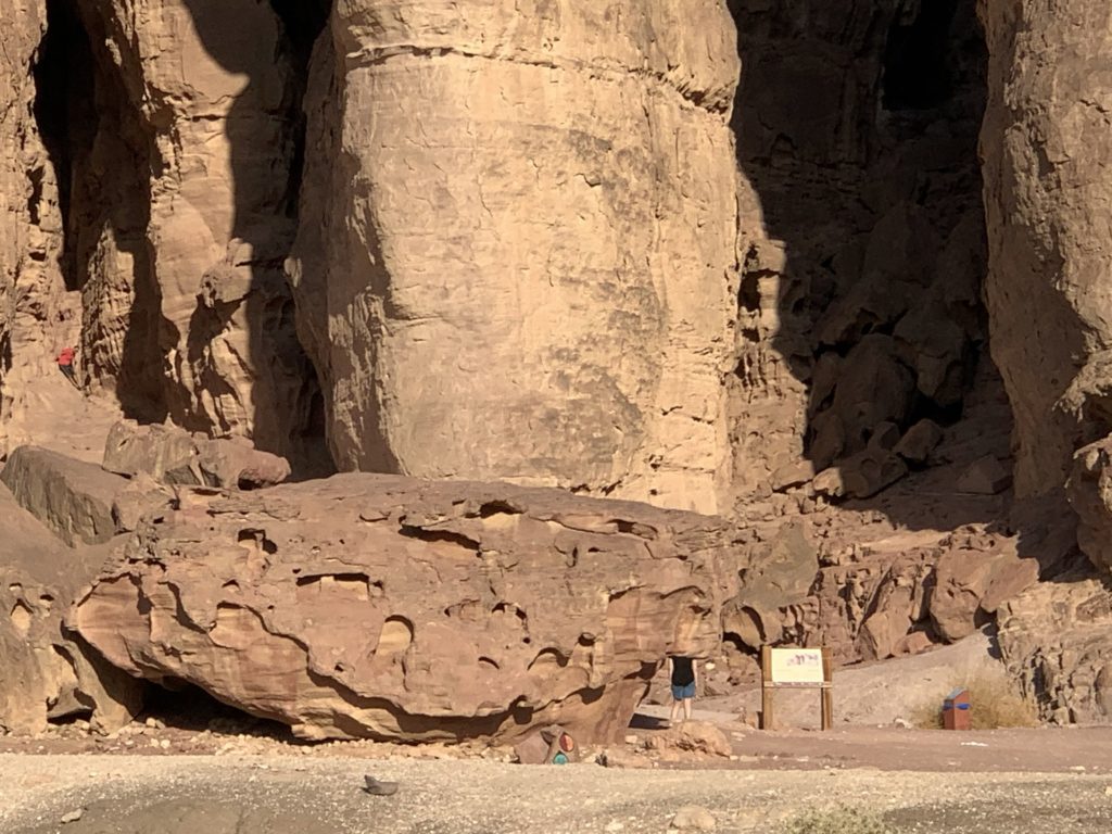
The valley of Timnaʿ sits about 20 miles north of the Gulf of Aqaba. The location stands out for its copper mining operations for at least 5,000 years. Only Spain’s southern region of Rio Tinto can claim such a long history of mining metals. High cliffs (1,600–2,300 feet high) surround the valley on three sides, with the east end of the valley opening into the Arabah. A free-standing mountain rises 1,500 feet from the middle of the valley floor. The erosion of its sandstone has left some features known as “Solomon’s Pillars” (see photo below).
John Petherick in 1845 and 1861 appears to be the first to note the significance of the area with regard to copper smelting when he discovered some of the copper slag. In 1902 Alois Musil in 1902 and 1907 identified structural remains. Fritz Frank in 1934 found evidence of at least seven copper smelting sites. Nelson Glueck studied the pottery found in the area in 1935. As late as 1970 he claimed that Solomon operated copper mines and smelting here. Beno Rothenberg investigated the evidence in the valley in 1959–60 continued annual excavation and multi-disciplinary analyses in 1964. Rothenberg’s excavations and examinations of evidence indicated a gap in mining and smelting in the Middle Bronze Age (2200–1550 BC). After this gap both the Egyptians and the Midianites gained control of the resources and exploited them.
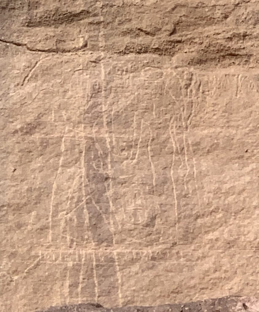
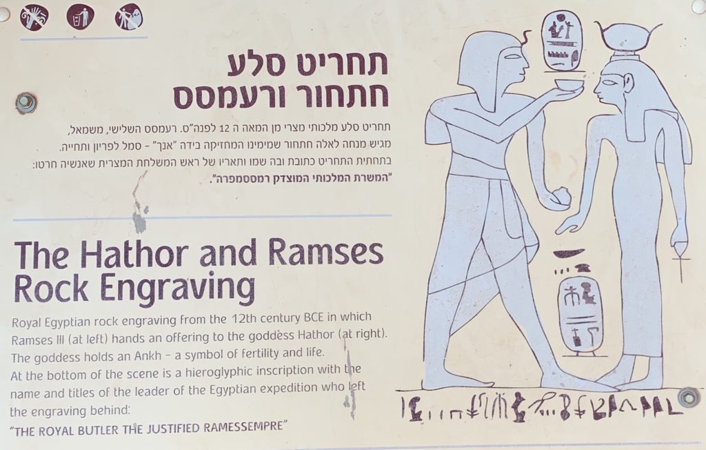
Both inscriptional and structural evidences testify to the period of Egyptian domination of the copper resources and their trade. The two photos below involve the Hathor Inscription located on the sandstone wall above the valley floor in the area of Solomon’s Pillars. The inscription depicts Pharaoh Ramses III (1187–1156 BC) standing before the goddess Hathor. Nearby, at the basis of this sandstone formation, archaeologists uncovered a temple to Hathor where copper mine workers would have worshipped the goddess.
Another gap in copper mining and smelting occurs from the 12th century until the Nabataean Period (100 BC–AD 300), eliminating any use of the mines or smelting furnaces by Solomon. The copper and bronze materials available to Solomon appear to have been due to David’s military operations and their successes (see 1 Chronicles 18:8–10; 22:3–14).
Solomon’s Pillars consist of the Amudei Shelomo Formation of Cambrian sandstone. At their base there exists a visible unconformity (erosion surface) that sits atop Precambrian rocks. According to geologist Andrew Snelling,.
The similarity of the Amudei Shelomo Formation sandstone … to the Tapeats Sandstone is remarkable, given they now outcrop on different continents thousands of kilometers apart. Yet there is no question that they correlate as direct equivalents, both in their stratigraphic position and in their make-up. There is also the enormous scale of these continent-wide sand deposits, which were formed at the same time and in the same way. This is not to suggest they could have been the same single deposit of sand. Rather, they are consistent with a single global event forming them both at the same time in the same way. Nothing like this is happening today, so the present is not the key to the past, as conventionally thought. Today’s slow-and-gradual geologic processes are not depositing the same uniform sand beds with basal conglomerates on an unconformity surface right across two continents at the same time. These two very similar, equivalent and enormous sandstone layers are instead remarkable testimony to the onset of the global Flood cataclysm. With the breaking up of the pre-Flood crust, both oceanic and continental, and the initiation of catastrophic plate tectonics, the margin of the pre-Flood supercontinent collapsed, and the rising ocean waters energized into repeated tsunamis by the catastrophic earthquakes swept up onto and right across the continental plates, bringing sand and other sediments with them scraped off the shallow ocean floors, and eroded off the pre-Flood crystalline basement to produce more sand and other sediments, which were then deposited across that eroded and peneplaned, continent-wide unconformity surface (Austin et al. 1994; Austin and Wise 1994; Baumgardner 2003; Snelling 2009a).
— Andrew A. Snelling, “The Geology of Israel within the Biblical Creation-flood Framework of History: 2. The Flood Rocks,” Answers Research Journal 3 (2010): 278
The Tapeats Sandstone about which Snelling speaks is the bottom layer of the sequence of horizontal water-deposited sediments visible in the Grand Canyon in Arizona. Below the Tapeats Sandstone lies the Great Unconformity, the boundary between Cambrian rock and Precambrian rock. This unconformity exists globally. With the help of geologist John Whitmore of Cedarville University, we were able to confirm this observation and see it for ourselves in the Timnaʿ Valley..
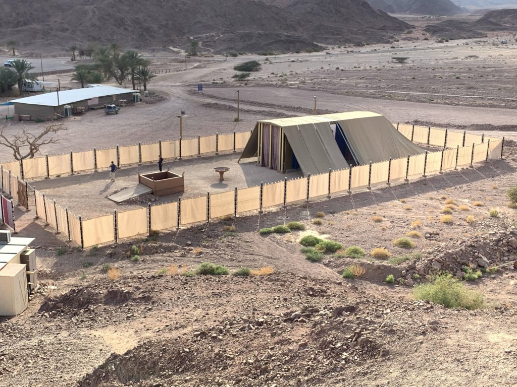
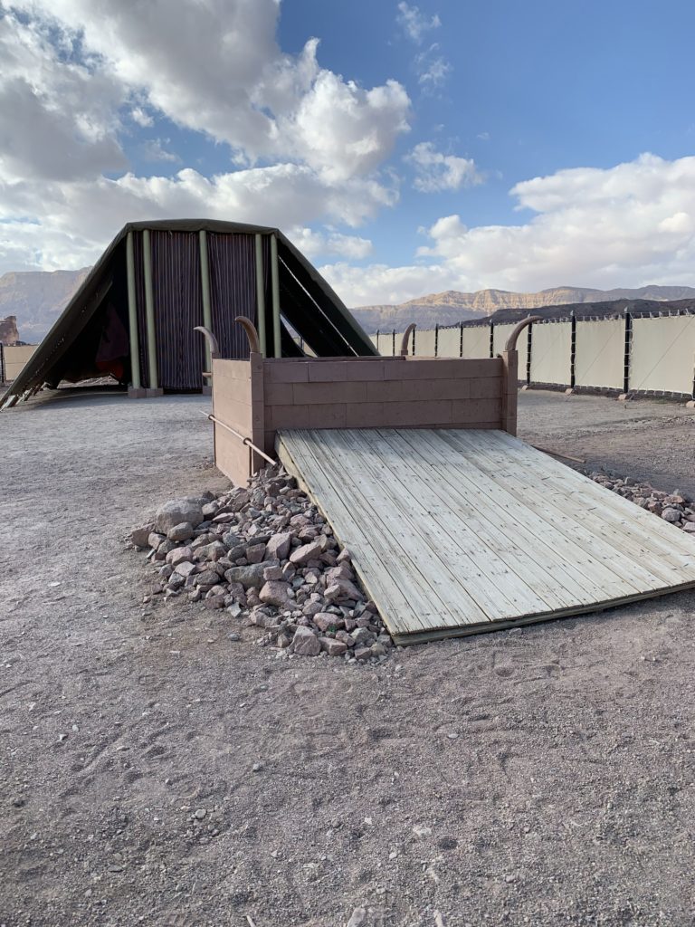
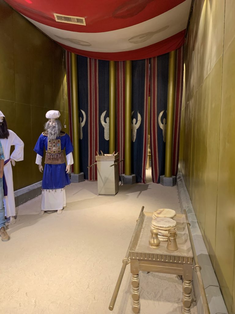
Since we arrived at Timnaʿ Park in the afternoon, before we searched for the Great Unconformity we first took a guided tour of the model of the Tabernacle. I recommend this tour very highly — we were overwhelmed by the superb message of atoning sacrifice involved in the significance of the Tabernacle’s furnishings and priestly ministry. The “Tabernacle Model: Timnah” video by Biblical Israel Ministry and Tours will provide you with an 8-1/2 minute tour of the model. Also, visit Todd Bolen’s website for more pictures and commentary on the model of the Tabernacle at Timnaʿ.
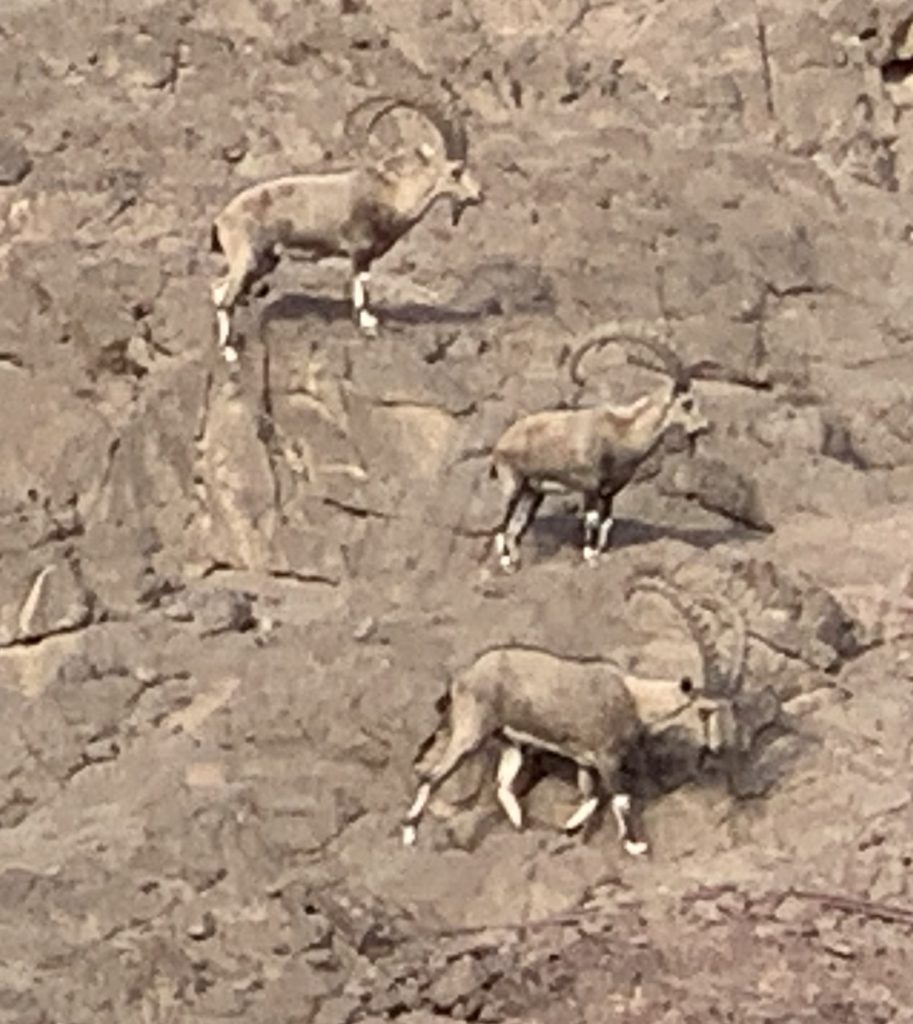
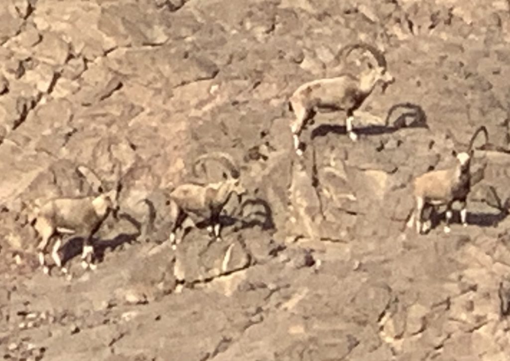
When we completed our guided tour of the model of the Tabernacle, we spotted group of ibex on the hillside above the model. We watched them move across the face of the slope, taking pictures as they went — they looked back at us, perhaps wondering what we were doing there.
Additional resources for studying Timnaʿ include: “Archaeology in Israel: Timna,” Jewish Virtual Library. The “Tabernacle of Moses at Timna Park” video gives a tour of a number of sites within the valley, including the model of the Tabernacle and an interesting suggestion regarding a connection between the elements of the Tabernacle and the seven “I AM” declarations of Jesus in the Gospel of John..
Gulf of Aqaba
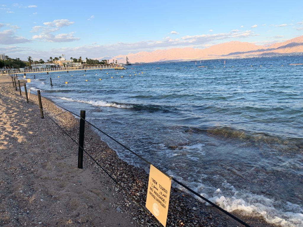
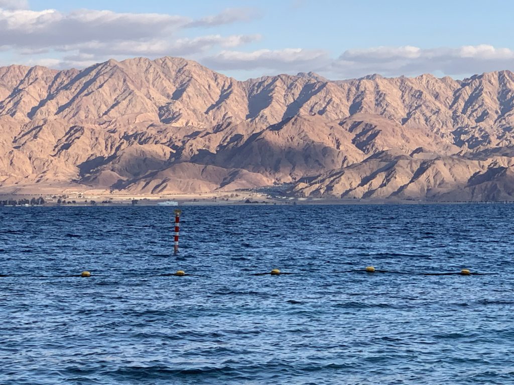
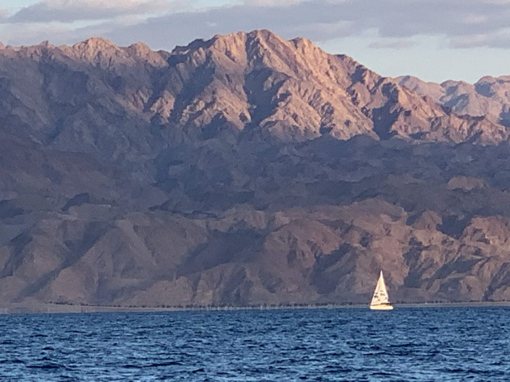
Our final destination involved a quick drive south to Eilat at the head of the Gulf of Aqaba. Our purpose (at least for some of us) involved taking a swim and viewing the fish along the coral reef. Others of us, however, chose to take in the sight of a glorious sunset over the distant hills of Jordan and Saudi Arabia. Solomon (971–931 BC) selected the port on the northern end of this arm of the Red Sea for a fleet of ships to bring goods to Israel from distant lands (1 Kings 9:26–28; 10:11). King Uzziah (792–740 BC) also followed Solomon’s example in developing shipping and trade through this port (2 Kings 14:22). The ancient trade route known as the King’s Highway (Numbers 20:17; 21:22) ran from this location north to the Tigris and Euphrates valleys in Mesopotamia.
Elath could have been El-paran (Genesis 14:6) — but not possible to demonstrate adequately. Elah, one of the Edomite chieftains (Genesis 36:40; 1 Chronicles 1:51) could be the origin of the name of this location since the following chieftain in the list, Pinon, might be connected with Punon in the Arabah (Numbers 33:42–43). According to Deuteronomy 2:8, Moses led the Israelites from Elath around Edom, to avoid violating their territory.
Dr. Barrick,
Thank you so much for this post, #3 from Israel. I had the opportunity to volunteer in Israel for five months from December 2016 to May 2017. I traveled this same route with two friends in February of 2017. We drove from the Galilee to Timna Park to Eilat. What a wonderful adventure we had! I have many of the same photos as you except mine are selfie’s 😂 and I did not have all of the background information that you have provided here. Thank you!
You have stirred up many wonderful memories.
I just signed up for your Grammar for Biblical Hebrew class. I may no longer be in Israel but Israel will always be in my heart.
Thank you for your encouraging words, Sherry. Glad the post brought back wonderful memories of your own visit to Timna. The Smithsonian Channel had a very good episode of “Secrets” devoted to the copper mining at Timna. Enjoy your study of Hebrew!